Journey to the Arctic: A Complete Travel Guide to the Dempster Highway in a Truck Camper
The Dempster Highway is one of North America’s last great overland adventures: 740+ kilometers of remote wilderness, endless tundra, razorback mountains, and gravel roads stretching all the way to the Arctic Circle and beyond. For many travelers, driving this legendary route in a truck camper represents the perfect combination of rugged capability and home-on-wheels comfort.
Whether you’re drawn by the midnight sun, the sweeping landscapes of the Tombstone Range, or simply the ambition to reach the Arctic Circle under your own power, this guide will walk you through every essential stop, key requirement, and tip for making your journey safe, memorable, and extraordinary.
Why the Dempster Highway?
Unlike Alaska’s Dalton Highway or other northern routes, the Dempster offers a rare sense of raw, untouched wilderness. There are no billboards, no resorts, and only two small communities (Eagle Plains and Fort McPherson) before the Northwest Territories border. What you gain in solitude, you trade for preparation—but that’s part of its magic.
A truck camper performs exceptionally well here:
- High clearance for ruts and washouts
- All-in-one living space
- Ability to camp anywhere without needing hookups
- Flexibility for side roads, pullouts, and spur trails
This makes the Dempster not just a road trip, but a mobile expedition.
Preparing for the Trip
Best Time of Year
The Dempster is open year-round, but most travelers visit June through early September, when conditions are safest.
- June–July: Midnight sun, wildflowers, best weather
- August: Fall colours explode across the tundra
- September: Chance of early snow; still stunning, but more unpredictable
Keep in mind: even in midsummer, snow can fall without warning.
Road Conditions
The highway is 100% gravel, and conditions vary by the hour.
Expect:
- Sharp shale rock (tire risk)
- Washboard sections
- Soft shoulders
- Construction delays
- Dust (or mud) depending on rain
Your truck camper should be in solid mechanical condition with good all-terrain tires and a full-size spare (two spares is even better).
What to Bring
The golden rule: Prepare like you won’t see services for two days.
Critical items:
- 2x full-size spare tires
- Tire patch kit & compressor
- Extra fuel (jerry cans)
- Extra food + water
- Engine fluids
- Bug spray + head nets
- Cash (rare card outages)
- Satellite communicator or InReach
- Detailed paper maps
For your camper:
- Full propane tanks
- Warm bedding (it gets cold even in summer)
- Leveling blocks
- Tools for minor repairs
Cell service is nearly non-existent except at Eagle Plains and a few high ridges.
The Route: Key Stops Along the Dempster
This section walks you northbound from Dawson City, Yukon to the Arctic Circle, highlighting the best spots to visit and camp.
Dawson City (KM 0)
Before you start the Dempster, Dawson is your final major resupply point. It’s quirky, historic, and full of northern charm.
What to do here
- Visit the goldfields on Bonanza Creek
- Stop at the Dänojà Zho Cultural Centre
- Catch the can-can show at Diamond Tooth Gertie’s
- Fuel up and stock groceries
Camping option
- Klondike River Campground (just before turning onto the Dempster)
Dempster Highway Entrance & Tombstone Interpretive Centre (KM 0–72)
The first section climbs quickly into the Ogilvie Mountains. Within an hour, the scenery changes from boreal forest to open alpine expanses.
Key stop: Tombstone Territorial Park
This is one of Canada’s most spectacular wilderness areas, often called the “Patagonia of the North.”
Don’t miss:
- Tombstone Interpretive Centre (trail info + exhibits)
- Grizzly Lake Trailhead (a legendary multi-day hike)
- Surfbird Mountain viewpoint
- North Klondike viewpoint for extreme mountain panoramas
Camping
- Tombstone Campground – first-come-first-served, beautiful, popular
- Many highway pullouts for boondocking
This is arguably the most scenic part of the entire route.
North Fork Pass & Chapman Lake (KM 80–115)
As you travel deeper into Tombstone, the topography shifts into sweeping U-shaped valleys and gentle tundra hills.
Best features
- Chapman Lake – peaceful (often mirror-like), good for photos
- Frequent wildlife sightings: caribou, foxes, and occasionally grizzlies
- Vibrant alpine wildflowers in early July
If you’re into photography, sunrise here lights the mountains on fire with gold and purple.
The Blackstone Uplands (KM 110–170)
This is where the feeling of true remoteness begins. The landscape opens into rolling tundra plateaus; visibility stretches forever.
Why stop here
- Incredible chances to see wildlife
- Great area for short ridge walks
- Very few other vehicles
Camping
Roadside pullouts offer spectacular views and total silence.
Ogilvie Ridge & Engineer Creek (KM 190–226)
Here the highway enters steeper, more rugged geology.
Highlights
- Ogilvie Ridge Viewpoint: One of the most iconic photo spots on the Dempster
- Engineer Creek Campground: Full of mineral-rich creeks and unusual coloured mountains
The colours range from brown to orange to deep grey due to the mineral variations.
Eagle Plains (KM 369)
This is the only true service area between Dawson and the Arctic Circle.
Services offered
- Fuel (often expensive)
- Restaurant & lounge
- Motel
- Small automotive shop
- Tire repair sometimes available
Eagle Plains isn’t fancy, but it’s essential—and always a fun meeting point for other northern travelers.
Camping
- Eagle Plains RV Park (basic but functional)
- Highway pullouts before and after the lodge
Crossing Into the Arctic
Arctic Circle Sign (KM 405)
This is the moment most travelers come for: crossing the 66° 33′ North latitude line. There’s a large pullout and a prominent sign perfect for photos, cooking lunch, or simply taking a moment to soak it all in.
What to expect
- Strong winds
- Cooler temperatures
- Expansive, rolling tundra
- No trees
In late August, the fall colours here are breathtaking—reds, golds, and deep oranges stretching to the horizon.
Camping
You’re allowed to camp at the pullout if conditions are calm. The light at night is unbelievable.
Beyond the Arctic Circle (Optional Extensions)
Most travelers continue beyond the Arctic Circle, and if you have the time, it’s worth the push.
Fort McPherson (KM 544)
A Gwich’in community with:
- Fuel
- Grocery store
- Local crafts
- Opportunity to learn about traditional northern life
Peel River & Mackenzie River Ferries
These ferries are free and operate in summer until freeze-up. The crossings are scenic and are a true highlight of the road.
Inuvik (KM 736)
A vibrant northern hub with:
- Hotels
- Restaurants
- Major resupply
- Western Arctic Visitor Centre
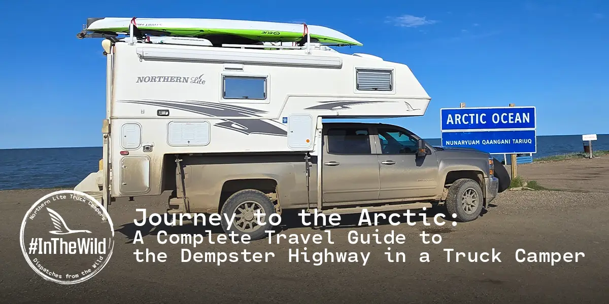
Tuktoyaktuk (via the Tuk Highway)
If you want to reach the Arctic Ocean, drive the all-season road from Inuvik to Tuktoyaktuk. Dip your toes in (warning: it’s freezing).
Wildlife Along the Way
The Dempster is home to:
- Caribou (Porcupine herd)
- Moose
- Grizzlies
- Arctic foxes
- Dall sheep
- Lynx (rare)
- Countless bird species
Safety tips:
- Never approach wildlife
- Store food inside your camper
- Carry bear spray when hiking
Grizzlies are common, especially from Tombstone north to the Arctic Circle.
Camping on the Dempster Highway
Your truck camper gives you maximum flexibility. Aside from the territorial campgrounds, you can camp at virtually any pullout unless otherwise posted.
Top Campgrounds
- Tombstone Territorial Park
- Engineer Creek
- Rock River (near NWT border)
- Reindeer Station area (NWT)
- Gwich’in Territorial Campground (Inuvik)
Pullout Camping Tips
- Park well off the road
- Use wheel chocks—wind gusts can be strong
- Avoid soft ground after rain
- Leave no trace
The silence is incredible. On clear nights, the sky glows with midnight sun or early-season auroras.
Tips for a Successful Dempster Highway Adventure
- Drive Slowly
The shale rock is notorious for shredding tires. Driving under 70 km/h dramatically reduces risk.
- Keep Your Lights On
Daytime running lights are mandatory for safety and visibility.
- Watch for Soft Shoulders
The gravel can be deceiving—vehicles sliding off the road is more common than you’d think.
- Call Ahead About Road Conditions
The Yukon government posts daily updates. Weather can flood roads or cause landslides.
- Fuel Up at Every Chance
Never skip a fuel stop, even if you’re half full. Distances are long and stations can randomly close.
- Don’t Rely on GPS
Navigation apps become unreliable. Use paper maps from:
- Tombstone Interpretive Centre
- Visitor centre in Dawson City
- Expect Slow Travel Times
Gravel, photo stops, and weather mean 250–300 km/day is normal.
- Bring Extra Bug Protection
In early summer, mosquitos can be intense. Head nets are lifesavers.
- Stay Weather Aware
If rain is forecast, plan extra time. The Dempster turns to slick clay in wet weather.
- Respect the Land
Many areas are traditional territories of the Gwich’in and Hän people. Appreciate with care.
Sample 7–10 Day Itinerary
Day 1: Dawson → Tombstone
Hiking + camping in the park.
Day 2: Tombstone → Eagle Plains
Stops at Ogilvie Ridge and Engineer Creek.
Day 3: Eagle Plains → Arctic Circle → NWT Border
Camp near Rock River.
Day 4: Rock River → Inuvik
Explore the Gwich’in communities and do short hikes.
Day 5: Inuvik → Tuktoyaktuk → Arctic Ocean
Evening back in Inuvik.
Day 6–7: Slow return south
Enjoy scenery from a new perspective.
Optional: Add days in Tombstone or Fort McPherson.
Final Thoughts: Why This Trip Stays With You Forever
The Dempster Highway is not your typical road trip. It’s a journey into Canada’s last great wilderness—a place where silence feels endless, the land stretches to infinity, and the midnight sun paints the sky gold at 2 a.m.
Traveling the Dempster in a truck camper gives you the freedom to stop anywhere, sleep anywhere, and immerse yourself in the changing landscapes at your own pace. It demands preparation and respect, but rewards you with one of the most unforgettable experiences in the world.
If you’re craving adventure, solitude, and a sense of being truly “out there,” the road to the Arctic Circle is calling.